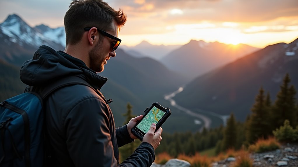
Like a compass needle drawn to true north, we're all searching for reliable ways to navigate the wilderness safely. In today's digital age, we've moved beyond paper maps and basic compasses to embrace sophisticated navigation apps that transform our smartphones into powerful tools for the trail. While traditional methods still have their place, modern backpacking apps offer features we couldn't have imagined just a decade ago. Let's explore how these technological companions are revolutionizing the way we plan, track, and safely complete our outdoor adventures.
Why Navigation Apps Matter
Nearly every backpacker today relies on navigation apps for added safety and convenience in the wilderness. As current navigation trends show, these digital tools have become essential companions for both novice and experienced hikers, complementing traditional navigation methods while adding layers of functionality that paper maps can't match.
User-friendly interfaces make these apps accessible to hikers of all skill levels. We've found that navigation apps excel in four key areas that align with different user preferences. First, they enhance our safety through real-time weather updates, emergency features, and location sharing with loved ones.
Second, they're fantastic for route planning, letting us search nearby trails and create custom routes with detailed elevation profiles.
Third, they boost our efficiency by organizing our hiking data and providing quick access to essential information.
Finally, they work alongside traditional navigation skills, serving as a reliable backup when we're exploring the great outdoors.
What's particularly valuable is that most apps offer offline capabilities, ensuring we can navigate even in areas without cell service.
This combination of convenience and reliability makes navigation apps an invaluable tool for modern backpacking adventures.
Essential Features to Look For
For backpackers choosing a navigation app, certain features stand out as must-haves for safe and effective wilderness travel.
We've found that the best apps combine reliable offline functionality with user generated content and customization options that let you make the experience your own. Many popular hiking apps offer real-time conditions and trail updates from fellow hikers.
When you're deep in the backcountry, you'll want an app that works without cell service and gives you confidence in your route.
Here are three essential features we recommend looking for:
- Downloadable offline maps with multiple layers, so you'll always have access to detailed terrain information even without service.
- Thorough route planning tools that show elevation profiles and estimated hiking times, letting you customize your adventure based on your abilities.
- GPS tracking and location sharing capabilities, enabling you to share your journey with friends while staying safe on the trail.
Top Rated Navigation Apps Today

While dozens of navigation apps crowd the digital marketplace, several standout options have earned widespread recognition among backpackers and outdoor enthusiasts.
When comparing the best hiking apps, Gaia GPS leads the pack with its robust topographic information and customizable display features, making it a favorite among seasoned adventurers.
We've found that AllTrails offers an excellent blend of navigation and community insights, letting you check trail reviews before heading out.
For those seeking advanced route-building capabilities, Caltopo stands out with its detailed graphic controls and editing tools. Many users appreciate its real-time traffic updates to help avoid congested areas near trailheads.
If you're looking for a straightforward option that won't overwhelm you with features, onX Backcountry delivers reliable performance and essential navigation tools.
Let's not forget Viewranger, which brings something unique to the table with its Skyview function – perfect for identifying peaks and discovering new trails.
When making navigation app comparisons, we always recommend considering offline capabilities, as cell service isn't guaranteed in the backcountry.
Each of these apps lets you download maps for offline use, though some may require a subscription or credit system.
Offline Navigation Capabilities

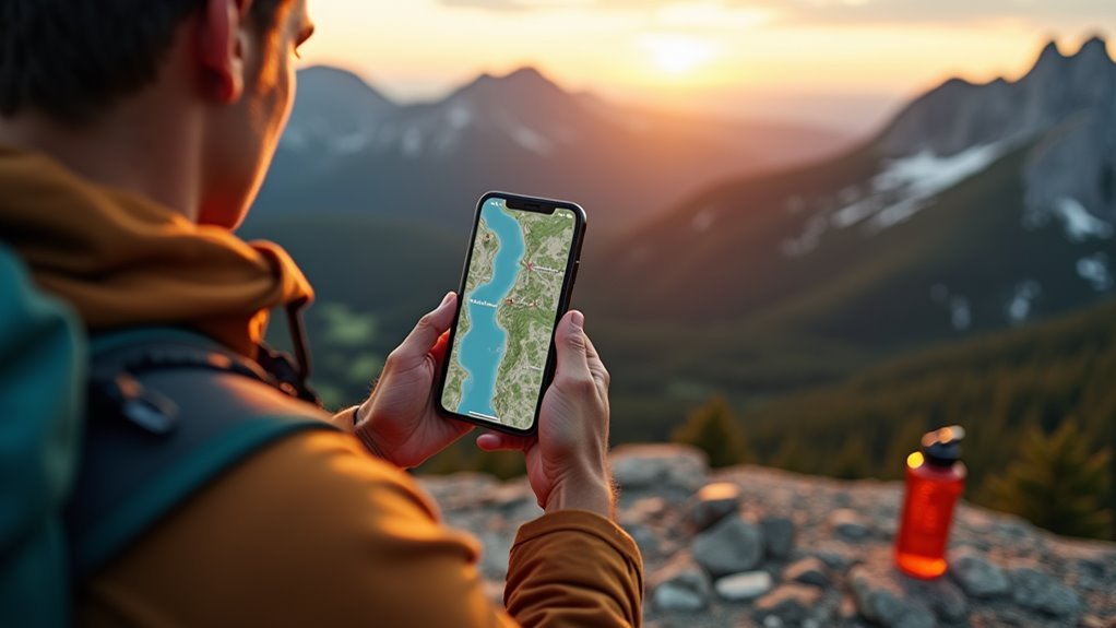
A backpacking app's true worth emerges when you're miles from cell service, making offline capabilities the backbone of reliable navigation.
Government Topo maps provide critical infrastructure and vegetation details that could make the difference in challenging terrain. We've found that successful offline map usage depends on downloading your maps before hitting the trail, and apps like GaiaGPS and AllTrails make this process straightforward. With downloaded routing data, you'll have everything you need right at your fingertips.
When it comes to route planning techniques, we recommend focusing on these essential features:
- Topographic maps with clear contour lines – they're absolutely vital for understanding terrain and planning safe routes
- GPX support for sharing tracks with your hiking buddies and importing routes from trusted sources
- Snap-to-trail functionality, which helps create accurate routes even when you're offline
The best part about modern navigation apps is their cross-platform support. You can plan your route on your computer at home, sync it to your phone, and head out with confidence.
Apps like ViewRanger even excel at battery conservation, using just 6.6% in 30 minutes when offline – perfect for those multi-day adventures where every bit of battery life counts.
Safety and Emergency Features
In the wilderness, safety features can mean the difference between a close call and a serious emergency. Today's navigation apps pack powerful tools that boost our emergency preparedness while exploring the great outdoors.
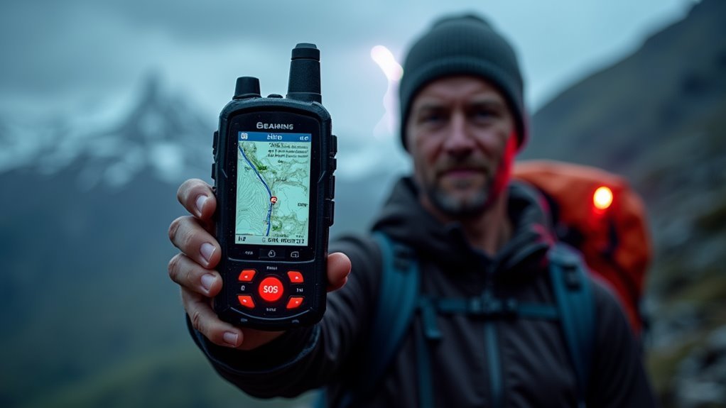
We're especially impressed with apps that offer SOS buttons and real-time location sharing, letting us quickly alert rescue services or family members if we need help.
When we're deep in the backcountry, device reliability becomes essential. That's why we love apps that work with satellite communicators like Spot X or Garmin InReach, providing two-way messaging even without cell service. These devices offer superior accuracy in natural settings compared to standard smartphones.
These apps also let us send pre-set emergency messages and share GPS coordinates with search and rescue teams.
Beyond emergency features, we've found that safety tracking tools like route deviation alerts and weather updates help prevent dangerous situations before they happen.
Many apps now include offline maps, topographic navigation, and even first aid information.
With community support features, we can also learn from other hikers' experiences and stay informed about trail conditions before heading out.
Battery Management Tips
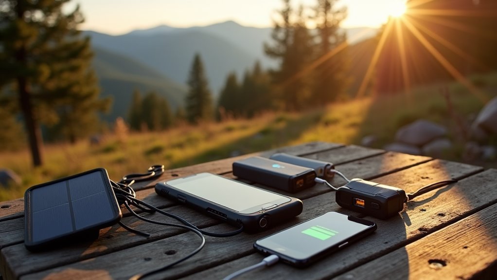
Managing your device's battery life effectively can make or break a backpacking adventure. We've found that implementing smart battery saving strategies can reduce your device's daily power consumption to just 3%.
By combining power management techniques with the right portable chargers, you'll keep your navigation apps running throughout your journey. Sleep mode during breaks is often more efficient than frequently turning your phone on and off.
Let's make sure you're prepared with these essential power management tips:
- Switch to airplane mode when you're not actively using your phone – this stops your device from constantly searching for cell towers and can dramatically extend battery life.
- Pack a backup battery of at least 10,000 mAh for multi-day trips, and don't forget to bring a spare charging cable.
- Download offline maps before your trip and use power-saving navigation apps that work without constant data connections.
Remember to adjust your screen brightness and turn off unnecessary features like location services for unused apps.
We also recommend enabling Low Power Mode, which enhances your device's performance while reducing background activity.
User Experience and Reviews
Popular mapping apps stand out for their distinct features and user experiences, with each offering unique strengths for different types of backpackers. Based on user feedback, Gaia GPS and AllTrails lead the pack with their intuitive user interfaces, making it easy for anyone to start exploring right away.
We've found that while Gaia GPS offers more customization options, AllTrails shines with its extensive trail database. For those seeking affordable options, Wikiloc at $9.99/year provides great value for trail discovery.
For those who love diving deep into mapping details, Caltopo's advanced features might seem overwhelming at first, but they're worth mastering if you're serious about route planning.
FarOut has earned praise from thru-hikers who appreciate its detailed trail guides and community updates. The user interface feels like having a trail companion in your pocket.
When it comes to real-world performance, each app has its sweet spot.
We've noticed that while onX Backcountry's trail guides are thorough, you'll want to double-check user-generated content.
OsmAnd offers incredible customization but requires patience to learn – it's like having a powerful tool that takes time to master.
Frequently Asked Questions
Can Navigation Apps Work Without Cell Service in Remote Wilderness Areas?
We can rely on navigation apps in remote areas when we've downloaded offline maps beforehand. Our phones maintain GPS accuracy without cell service, letting us track location wherever we roam.
Which Navigation App Consumes the Least Amount of Phone Battery Power?
We've found GAIA GPS uses the least battery power among navigation apps, especially when using its battery saving features. It drains only 2% per hour compared to other apps' higher consumption rates.
Are Premium Versions of Hiking Apps Worth the Extra Cost?
We've found premium features are absolutely worth it if you're hitting trails regularly. User reviews consistently show they're game-changers for safety, planning, and peace of mind in remote areas.
How Accurate Are Elevation Readings on Smartphone Navigation Apps?
We'll get elevation accuracy within 30-100 feet from smartphone apps. While that's good enough for most hikes, don't rely solely on GPS reliability when traversing challenging terrain.
Can Multiple Hiking Apps Be Used Simultaneously Without Affecting Phone Performance?
We'll experience noticeable performance impact when running multiple hiking apps together, even with good app compatibility. Let's stick to one primary app to keep our phone running smoothly.
Conclusion
While we've explored the best navigation apps to keep us from getting lost in the wilderness, isn't it ironic that we're becoming more dependent on technology to find our way back to nature? Still, we're confident these tools make outdoor adventures safer and more accessible. Let's embrace this digital evolution of traditional navigation while remembering to pack backup batteries – because even the best app can't help with a dead phone.